
Keyword
Practical salinity of the water body
1421 record(s)
Type of resources
Topics
Keywords
Contact for the resource
Provided by
Formats
Update frequencies
Status
draft
-
This record contains data collected from the near-water surface sampling site off the Lucinda Jetty, as part of the Lucinda Jetty Coastal Observatory. Sample collection began the 9th of January, 2014. The data can be used for Ocean Colour sensor validation. Parameters measured include the absorption coefficients of the particulate and dissolved components of the water column and the phytoplankton pigment concentration and composition.
-
This dataset contains the Underway (UWY) data collected on commercial ferries plying the Rottnest to mainland route. Voyages take place on a commercial schedule. A Seabird SBE38 sensor is permanently mounted on the ferry in the engine cooling waster intake. A monitoring computer records sea surface temperature whenever the vessel achieves more than a minimum preprogrammed speed over ground. Position is determined from a GPS unit. Data is transmitted to CSIRO Marine and Atmospheric Research centre in Hobart on the hour every hour. The vessel traverses the route from Hillarys Boat harbour to Rottnest 3 or four times per day except during a winter vessel maintenance period. This dataset has been processed and is archived within the CSIRO Marine and Atmospheric Research Data Centre in Floreat.
-
This record describes expendable bathythermograph (XBT) and expendable conductivity-temperature-depth profiler (XCTD) data collected on the Japanese deep-sea research vessel Kairei voyage KR16-LHR, titled '2016FY Acquisition of deep seismic, shallow sub-surface and seafloor bathymetry Survey Data for the Lord Howe Rise (MCS, OBS).' The vessel conducted marine scientific research in the Australian EEZ between 23 March and 11 May 2016. The survey consisted of three legs: Leg1: 23 March - 30 March, Brisbane (QLD) to Brisbane Leg2: 2 April - 20 April, Brisbane to Brisbane Leg3: 22 April - 11 May, Brisbane to Brisbane A total of 1 XBT and 4 XCTD casts were conducted over the duration of this voyage: Type / Date / Time (UTC) / Latitude / Longitude / Type XBT T05 / 20160324 / 180644 / 27o22.9720S / 162o26.4646E XCTD CT2 / 20160402 / 224128 / 27o13.0832S / 155o33.4541E XCTD CT2 / 20160408 / 120230 / 27o23.0842S / 161o34.4947E XCTD CT2 / 20160415 / 022902 / 27o31.1244S / 160o10.1520E XCTD CT2 / 20160425 / 023019 / 26o25.6134S / 161o14.2481E Data are stored in ASCII and comma-separated files at CSIRO. Profile plots in PDF format are also part of the dataset. Additional information regarding this dataset is contained in the cruise summary report (see link below).
-
3D plume mapping was conducted over a 10day period at Chevron's Wheatstone dredging operation near Onslow Western Australia. Dredge plums created by a cutter suction dredge were sampled from CSIRO vessel RV Linnaeus on voyage number LI2013_v25. Underway measurements were made using a ship mounted ADCP to measure vertical velocity profiles and backscatter intensity and DALEC that measured the spectral qualities of incoming and reflected sea surface light. Profile data were collected using LISST (particle size distributions), CTD (backscatter, temperature and salinity), Hydroscat, Hydrorad (used measure light profiles, extinction coefficients , and scattering properties). Surface and bottom water samples were be collected at selected sites and analyzed for particle size distributions
-
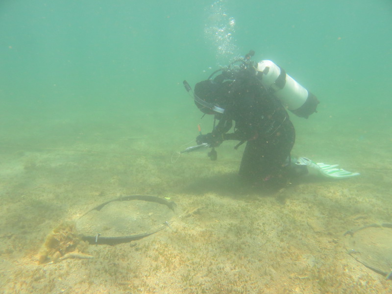
The objective of Project 5.4 was to determine whether recovery of seagrass in the Pilbara following disturbance is by sexual (recruitment from seeds) or asexual (vegetative regrowth from rhizome extension) means, and the relative importance of each, thereby determining the capacity, timeframes and mechanisms of recovery from light and sediment deposition effects. This was achieved through an experiment in which plots cleared of seagrass were enclosed by a barrier or left open, and changes in cover were compared to unmanipulated control (and procedural control) plots. The experiment was done at two sites, a 2-m deep (the 'shallow' site) and a 6-m deep (the 'deep' site). The experiment was intended to run for 6 months, but after 5 months disturbance caused by Tropical Cyclone (TC) Olwyn reduced seagrass cover at both sites, and removed the experimental apparatus at the shallow site. Nevertheless, results yielded by surveys prior to TC Olwyn unambiguously showed strong evidence for recovery through vegetative regrowth (full recovery in cleared plots with no barriers, plus a pattern of increasing cover from the edges of the plots) and no evidence for recovery through recruitment from seeds (no seagrass was ever recorded in any cleared plot with a barrier). The main species of seagrass present was Halophila ovalis, which is widespread throughout northwestern Australia. The transferability of inferences from this study to other places in the Pilbara is hampered by the substantial variation in abundance and species composition from place to place - different species might have different mechanisms of recovery. The nature of the experimental disturbance (complete removal of all seagrass, including roots and rhizomes) is a reasonable facsimile of a severe dredging-induced disturbance, but the spatial extent of the experimental clearances (~0.5 m2) is orders of magnitude smaller than the spatial extents of dredging-induced mortality induced elsewhere: it is plausible that recovery of patches within meadows is more easily achieved through rhizome extension than recovery that encompasses spatial extents of hectares.
-
This dataset contains data collected from 24/2/97 to 24/8/98 in the Lower Reaches of the Huon Estuary, Tasmania. One day surveys were carried out on five occassions on the day preceding HES4, HES5, HES6, HES9 and HES10 (see Huon Estuary Study - Spatial Survey Data 1996-1998 for details of these surveys). Physical Snapshots Surveys 1(PS01) & 2(PS02) took the form of a number of rapidly deployed CTD's and underway data collection. For Physical Snapshots Surveys 3(PS03), 4(PSO4) & 5(PS05) only the underway system was deployed.
-
This dataset contains the processed Conductivity-Temperature-Depth (CTD) data collected on Soela voyage SO 8/87. The voyage took place in the east Indian Ocean during 4 November - 15 December 1987. This dataset has been processed and is archived within the CSIRO Marine and Atmospheric Research Data Centre in Hobart. Additional information regarding this dataset is contained in the cruise report for this voyage and/or the data processing report (as available).
-
This dataset contains the processed Conductivity-Temperature-Depth (CTD) data collected on Sprightly cruise SP 03/84. The cruise took place in NSW coastal waters during March 1984, carrying out hydrology sections for the ACE (Australian Coastal Experiment) Project, located off Cape Howe, Stanwell Park, Jervis Bay (Beecroft Head), Cronulla, and Newcastle, with stations at 14 points between 20m and 15km offshore. This dataset has been processed and is archived within the CSIRO Marine and Atmospheric Research Data Centre in Hobart. Additional information regarding this dataset is contained in the cruise report for this voyage. [Information taken from cruise plan, as cruise report not seen]
-
This dataset contains the processed Conductivity-Temperature-Depth (CTD) data collected on Franklin voyage FR 05/85. The voyage took place in the Coral Sea during 1 October - 5 November 1985. This dataset has been processed and is archived within the CSIRO Marine and Atmospheric Research Data Centre in Hobart. Additional information regarding this dataset is contained in the cruise report for this voyage and/or the data processing report (as available).
-
This dataset contains the processed Conductivity-Temperature-Depth (CTD) data collected on Franklin voyage FR 07/93. The voyage took place in the Tasman Sea during 11 September - 5 October 1993. This dataset has been processed and is archived within the CSIRO Marine and Atmospheric Research Data Centre in Hobart. Additional information regarding this dataset is contained in the cruise report for this voyage and/or the data processing report (as available).